Carnock Church Ruin ? South East Corner
Introduction
The photograph on this page of Carnock Church Ruin ? South East Corner by Nigel J C Turnbull as part of the Geograph project.
The Geograph project started in 2005 with the aim of publishing, organising and preserving representative images for every square kilometre of Great Britain, Ireland and the Isle of Man.

There are currently over 7.5m images from over 14,400 individuals and you can help contribute to the project by visiting https://www.geograph.org.uk
Carnock Church Ruin ? South East Corner
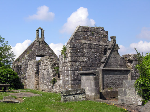
Image: © Nigel J C Turnbull Taken: 7 Jun 2008
Although this church has been a Ruin for a long time, the pointing of the stonework is in very good condition. I wonder if it is being maintained as a ‘Ruin’. An excerpt from an 1861 Parochial Directory, viewable here http://www.fifefhs.org/Records/Directory/carnock.htm . . . “The old Parish Church at Carnock was repaired in 1602, but is now in ruins, being roofless and overgrown with ivy. It was a small building, with only 240 sittings.”
Images are licensed for reuse under creativecommons.org/licenses/by-sa/2.0
Image Location


Leaflet Map data © OpenStreetMap
Latitude
56.085051
Longitude
-3.542485