Wallisdown: the boundary swaps sides
Introduction
The photograph on this page of Wallisdown: the boundary swaps sides by Chris Downer as part of the Geograph project.
The Geograph project started in 2005 with the aim of publishing, organising and preserving representative images for every square kilometre of Great Britain, Ireland and the Isle of Man.

There are currently over 7.5m images from over 14,400 individuals and you can help contribute to the project by visiting https://www.geograph.org.uk
Wallisdown: the boundary swaps sides
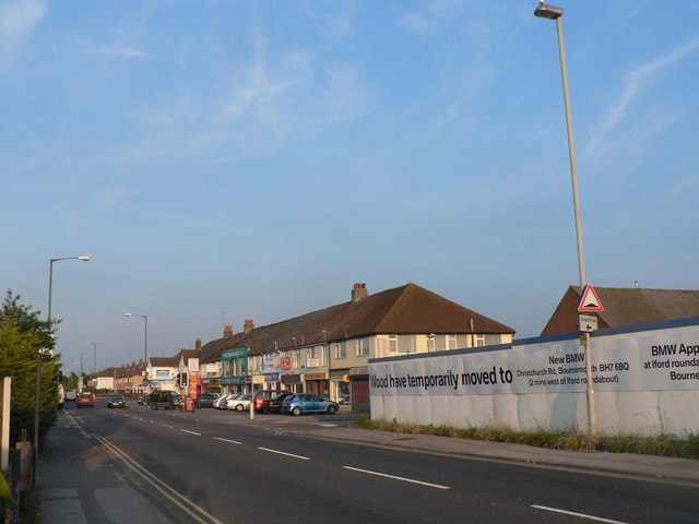
Image: © Chris Downer Taken: 8 Jun 2008
Wallisdown Road is two miles long and dead straight apart from one small bend, and throughout its length it is the boundary of Bournemouth and Poole boroughs. At the crossroads pictured, for some reason having hugged the frontages of properties on the south side, it crosses the road and then hugs the northern frontages for the remainder of the road (behind camera). This means that Poole maintains the road itself from this point westwards, while Bournemouth maintains it into the distance. This is demonstrated by the white, Poole lamppost in the foreground with more distant lampposts being Bournemouth's green. (Also, there is a Poole litter bin outside the row of shops shown here, and a Bournemouth bin outside the shops opposite.) However, all the even numbered properties (left) in Wallisdown Road are in Bournemouth, while odds are in Poole.
Images are licensed for reuse under creativecommons.org/licenses/by-sa/2.0
Image Location


Leaflet Map data © OpenStreetMap
Latitude
50.746471
Longitude
-1.911504