Siloam Baptist Chapel, Upper Cwmbran
Introduction
The photograph on this page of Siloam Baptist Chapel, Upper Cwmbran by Eirian Evans as part of the Geograph project.
The Geograph project started in 2005 with the aim of publishing, organising and preserving representative images for every square kilometre of Great Britain, Ireland and the Isle of Man.

There are currently over 7.5m images from over 14,400 individuals and you can help contribute to the project by visiting https://www.geograph.org.uk
Siloam Baptist Chapel, Upper Cwmbran
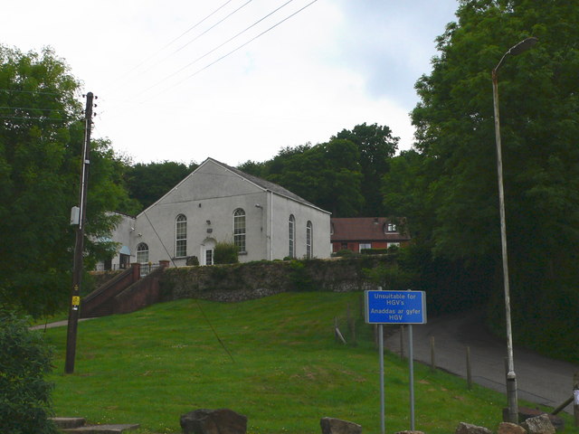
Image: © Eirian Evans Taken: 31 May 2008
According to tradition, meetings of Baptists in the Upper Cwmbran area were held in people's homes until the chapel was built in 1838. This date follows very closely on the opening of the Porthmawr Colliery- better known locally as the Clay level- and the expansion of the brickworks.
Images are licensed for reuse under creativecommons.org/licenses/by-sa/2.0
Image Location
Latitude
51.666165
Longitude
-3.051409