Bad Homburg Way
Introduction
The photograph on this page of Bad Homburg Way by Derek Harper as part of the Geograph project.
The Geograph project started in 2005 with the aim of publishing, organising and preserving representative images for every square kilometre of Great Britain, Ireland and the Isle of Man.

There are currently over 7.5m images from over 14,400 individuals and you can help contribute to the project by visiting https://www.geograph.org.uk
Bad Homburg Way
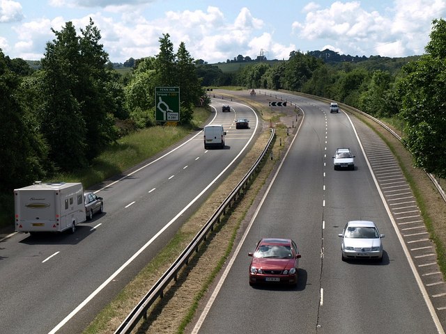
Image: © Derek Harper Taken: 5 Jun 2008
This is Image looking in the other direction from the same footbridge. The A380 climbs a little and then curves left to drop to the Penn Inn roundabout. This unnecessary hill implies that the designers planned for a flyover to carry the main road above the junction, and the descent would have been merely the slip road to the roundabout. Nearly thirty years later, this remains the end of the dual carriageway.
Images are licensed for reuse under creativecommons.org/licenses/by-sa/2.0
Image Location
Latitude
50.529049
Longitude
-3.592263