St Mary's church - chancel
Introduction
The photograph on this page of St Mary's church - chancel by Evelyn Simak as part of the Geograph project.
The Geograph project started in 2005 with the aim of publishing, organising and preserving representative images for every square kilometre of Great Britain, Ireland and the Isle of Man.

There are currently over 7.5m images from over 14,400 individuals and you can help contribute to the project by visiting https://www.geograph.org.uk
St Mary's church - chancel
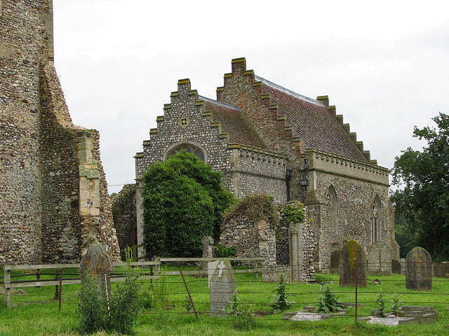
Image: © Evelyn Simak Taken: 4 Jul 2007
View towards the restored chancel, which now serves as the church building, past the gap where the nave once used to be; part of the ruined tower can be seen at left. See also > http://www.geograph.org.uk/photo/831160 . St Mary's is located on the grounds of Barningham Hall but there is free access for visitors to the church. The church fell into disuse after the Reformation; the chancel was restored > http://www.geograph.org.uk/photo/831164 and is still in regular use, whereas tower and nave did survive only as ruins. The original 13th century Purbeck marble font > http://www.geograph.org.uk/photo/831174 now stands in the tower. The perhaps most noteworthy feature of this church is the collection of medieval and continental glass > http://www.geograph.org.uk/photo/831193 - http://www.geograph.org.uk/photo/831196 with a rare royal arms created from stained glass inserted in the east window > http://www.geograph.org.uk/photo/831186. There is a large C15 brass on the south wall > http://www.geograph.org.uk/photo/831202. The unusual reredos is also the war memorial http://www.geograph.org.uk/photo/831181 - it depicts WWII soldiers in uniform. The church is open every day. For more information see: http://www.norfolkchurches.co.uk/barninghamwinter/barninghamwinter.htm
Images are licensed for reuse under creativecommons.org/licenses/by-sa/2.0
Image Location
Latitude
52.875722
Longitude
1.188963