St Mary's church - baptismal font
Introduction
The photograph on this page of St Mary's church - baptismal font by Evelyn Simak as part of the Geograph project.
The Geograph project started in 2005 with the aim of publishing, organising and preserving representative images for every square kilometre of Great Britain, Ireland and the Isle of Man.

There are currently over 7.5m images from over 14,400 individuals and you can help contribute to the project by visiting https://www.geograph.org.uk
St Mary's church - baptismal font
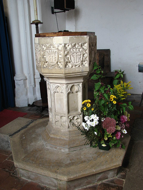
Image: © Evelyn Simak Taken: 30 Sep 2007
St Mary's church has a late medieval tower > http://www.geograph.org.uk/photo/831125 and a Saxon doorway; the chancel dates from the late 13th century as is evidenced by the angle piscina > http://www.geograph.org.uk/photo/831132 which is still in place. The interior was, however, extensively restored in the 19th century; medieval survivals are the C15 font, carved with arms of the Valoines family (seen here) and the original roof > http://www.geograph.org.uk/photo/831127 - dating from the same time. The church is open every day. For more information see: http://www.norfolkchurches.co.uk/barney/barney.htm
Images are licensed for reuse under creativecommons.org/licenses/by-sa/2.0
Image Location
Latitude
52.855664
Longitude
0.960035