Battersea gasworks
Introduction
The photograph on this page of Battersea gasworks by Nigel Cox as part of the Geograph project.
The Geograph project started in 2005 with the aim of publishing, organising and preserving representative images for every square kilometre of Great Britain, Ireland and the Isle of Man.

There are currently over 7.5m images from over 14,400 individuals and you can help contribute to the project by visiting https://www.geograph.org.uk
Battersea gasworks
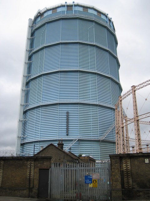
Image: © Nigel Cox Taken: 28 May 2008
There are three conventional gasometers, the latticework of the supports of one of which can be seen on the right, and this fixed sky blue tower structure, on the Battersea gasworks site. The three gasometers show up for the first time on the online available Ordnance Survey mapping of 1896, but this tower does not definitely appear until the 1938 Edition. Can any expert enlighten us at to its function?
Images are licensed for reuse under creativecommons.org/licenses/by-sa/2.0
Image Location
Latitude
51.478204
Longitude
-0.146691