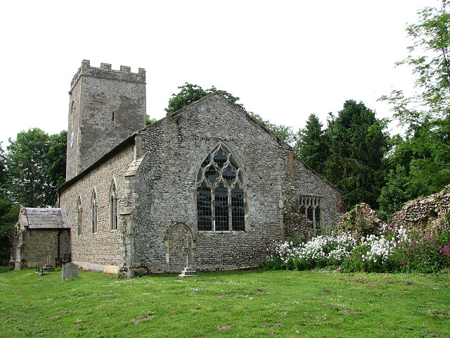
St Andrew's church
Introduction
The photograph on this page of St Andrew's church by Evelyn Simak as part of the Geograph project.
The Geograph project started in 2005 with the aim of publishing, organising and preserving representative images for every square kilometre of Great Britain, Ireland and the Isle of Man.
There are currently over 7.5m images from over 14,400 individuals and you can help contribute to the project by visiting https://www.geograph.org.uk

Image: © Evelyn Simak Taken: 2 Jun 2008
St Andrew's church > http://www.geograph.org.uk/photo/828726 is listed in the book "England's Thousand Best Churches" authored by Simon Jenkins. Because its chancel was demolished during the 18th century the building appears truncated. Part of the ruined chancel wall still stands and a profusion of wild flowers is growing on both sides > http://www.geograph.org.uk/photo/828676. The interior of the church is furnished with 18th century box pews > http://www.geograph.org.uk/photo/828740 simple benches and a three-decker pulpit > http://www.geograph.org.uk/photo/828735 - designed by James Burrough and originating from the old chapel of Corpus Christi College in Cambridge. There are a number of 18th century memorials in the sanctuary as well as on the south wall > http://www.geograph.org.uk/photo/828763. The church is open every day. For more information see: http://www.norfolkchurches.co.uk/thurning/thurning.htm

