Earl's Palace, Congregational Church & Manse
Introduction
The photograph on this page of Earl's Palace, Congregational Church & Manse by Kirsty Smith as part of the Geograph project.
The Geograph project started in 2005 with the aim of publishing, organising and preserving representative images for every square kilometre of Great Britain, Ireland and the Isle of Man.

There are currently over 7.5m images from over 14,400 individuals and you can help contribute to the project by visiting https://www.geograph.org.uk
Earl's Palace, Congregational Church & Manse
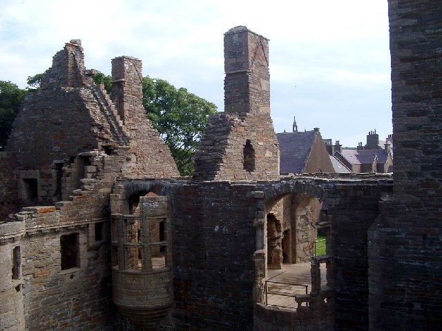
Image: © Kirsty Smith Taken: 6 Aug 2003
Showing the top of the Earl's Palace in Kirkwall, looking up Palace Road towards the airport, with the end of the Congregational Church and the rooves of the manse and other houses. The Earl in question was a bad lot - apparently got his kicks torturing and taxing the locals. My mother said this building exuded evil and refused to go into it, so ca' canny if you might be the same.
Images are licensed for reuse under creativecommons.org/licenses/by-sa/2.0
Image Location


Leaflet Map data © OpenStreetMap
Latitude
58.979897
Longitude
-2.958486