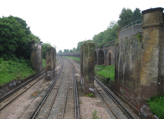
Putney: Railway line and dismantled viaduct
Introduction
The photograph on this page of Putney: Railway line and dismantled viaduct by Nigel Cox as part of the Geograph project.
The Geograph project started in 2005 with the aim of publishing, organising and preserving representative images for every square kilometre of Great Britain, Ireland and the Isle of Man.
There are currently over 7.5m images from over 14,400 individuals and you can help contribute to the project by visiting https://www.geograph.org.uk

Image: © Nigel Cox Taken: 28 May 2008
This is the view of the Network Rail tracks looking towards Wandsworth Town and Clapham Junction stations from the Woodlands Way pedestrian footbridge. Originally the London & South Western Railway built a junction here to enable trains to run directly between Clapham Junction and East Putney stations. The line was opened in 1889. The now-dismantled viaduct in the centre of the photograph would have carried eastbound 'up' trains from East Putney round to join the main line at a junction near Putney Bridge Road. The Southern Railway (the successors to the L&SWR) terminated passenger services in 1941, and eventually the decking of the flyover was removed. However the former westbound line towards East Putney still exists, on the long brick viaduct to the right, and is used occasionally for various non-passenger operational train movements with two-way working on the single track.

