East Putney Underground station
Introduction
The photograph on this page of East Putney Underground station by Nigel Cox as part of the Geograph project.
The Geograph project started in 2005 with the aim of publishing, organising and preserving representative images for every square kilometre of Great Britain, Ireland and the Isle of Man.

There are currently over 7.5m images from over 14,400 individuals and you can help contribute to the project by visiting https://www.geograph.org.uk
East Putney Underground station
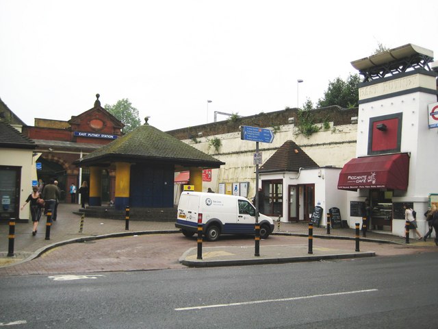
Image: © Nigel Cox Taken: 28 May 2008
The station dates from 1889 and was originally built by the Metropolitan Railway. It is in the centre of a Y-shaped arrangement of elevated railways. The railway on the east side of the Y is now disused, and District Line trains use the elevated route in the photograph which forms the western arm of the Y. The words 'East Putney' can just be picked out in relief at the top of the white buttress on the right. The van belongs to Tube Lines, yet another body with responsibility for running some part of the railway infrastructure, in this case providing maintenance services for trains and infrastructure on the Jubilee, Northern and Piccadilly lines...
Images are licensed for reuse under creativecommons.org/licenses/by-sa/2.0
Image Location
Latitude
51.458517
Longitude
-0.210825