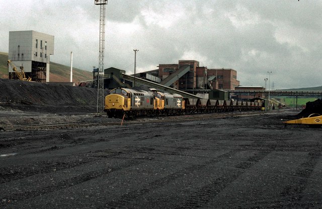
Mine, what mine?
Introduction
The photograph on this page of Mine, what mine? by roger geach as part of the Geograph project.
The Geograph project started in 2005 with the aim of publishing, organising and preserving representative images for every square kilometre of Great Britain, Ireland and the Isle of Man.
There are currently over 7.5m images from over 14,400 individuals and you can help contribute to the project by visiting https://www.geograph.org.uk

Image: © roger geach Taken: 11 May 1989
A reminder of South Wales's once great industrial past. Coal mines such as this were once found all over. Now there are no deep mines at all in South Wales. This location has been razed to the ground and the railway removed. Dr Steve Dumpleton, who was mine geologist here from 1982-1986, has confirmed that this is Abernant Colliery. The movement of coal by rail ceased not long after the picture was taken. Owing to the changes since I photographed this view my positions may not be exact, so any suggestions for a more precise location are welcome.

