Sutton Coldfield Town Sign, Watford Gap A5127
Introduction
The photograph on this page of Sutton Coldfield Town Sign, Watford Gap A5127 by Graham Taylor as part of the Geograph project.
The Geograph project started in 2005 with the aim of publishing, organising and preserving representative images for every square kilometre of Great Britain, Ireland and the Isle of Man.

There are currently over 7.5m images from over 14,400 individuals and you can help contribute to the project by visiting https://www.geograph.org.uk
Sutton Coldfield Town Sign, Watford Gap A5127
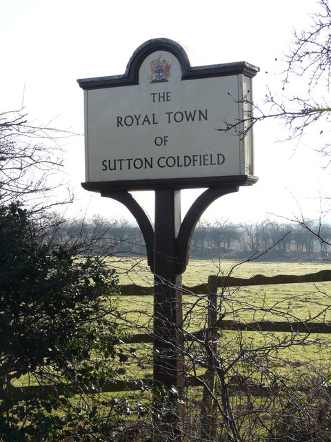
Image: © Graham Taylor Taken: 12 Feb 2008
There were similar signs on all main roads, at the boundary of the town of Sutton Coldfield. In 1974 Sutton Coldfield became part of Birmingham and the city council removed the Sutton Coldfield signs. Since then some have been purchased by private individuals and placed on private land as close as possible to their original locations. This particular one was about 1 metre closer to the camera. See also Image for updated information.
Images are licensed for reuse under creativecommons.org/licenses/by-sa/2.0
Image Location
Latitude
52.606581
Longitude
-1.837525