Moston station, looking north 1989
Introduction
The photograph on this page of Moston station, looking north 1989 by Peter Whatley as part of the Geograph project.
The Geograph project started in 2005 with the aim of publishing, organising and preserving representative images for every square kilometre of Great Britain, Ireland and the Isle of Man.

There are currently over 7.5m images from over 14,400 individuals and you can help contribute to the project by visiting https://www.geograph.org.uk
Moston station, looking north 1989
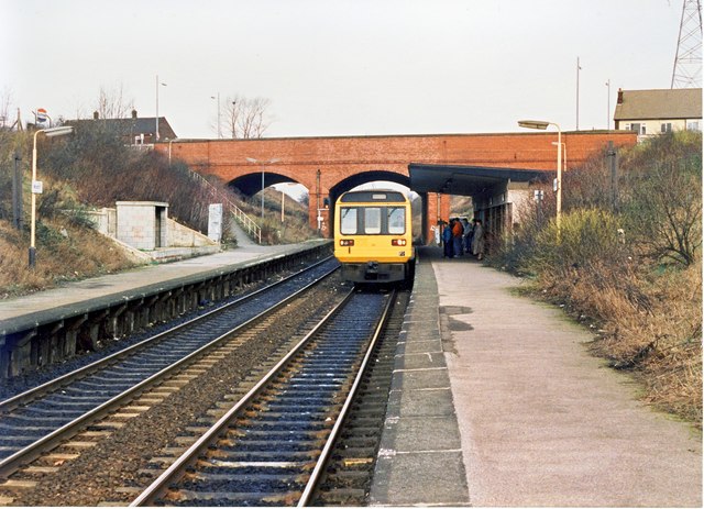
Image: © Peter Whatley Taken: 11 Feb 1989
By 1989 New Moston was an area in rapid decline. Moston station echoed that decline with reduced facilities and an increasingly derelict appearance. The weather had to be truly atrocious to make one use the breeze block shelter on the Rochdale platform. An absence of tall chimneys over the brow of Hollinwood Avenue bridge indicates that Chadderton power station has been demolished.
Images are licensed for reuse under creativecommons.org/licenses/by-sa/2.0
Image Location
Latitude
53.523005
Longitude
-2.171006