The Upper Welland bus turning area
Introduction
The photograph on this page of The Upper Welland bus turning area by Bob Embleton as part of the Geograph project.
The Geograph project started in 2005 with the aim of publishing, organising and preserving representative images for every square kilometre of Great Britain, Ireland and the Isle of Man.

There are currently over 7.5m images from over 14,400 individuals and you can help contribute to the project by visiting https://www.geograph.org.uk
The Upper Welland bus turning area
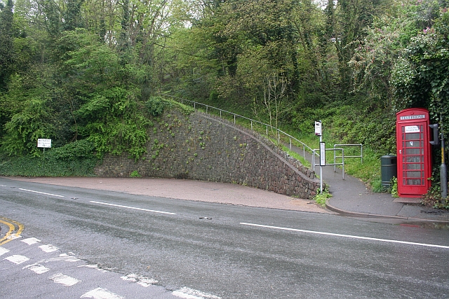
Image: © Bob Embleton Taken: 4 May 2008
Every twenty minutes double decker buses all the way from Birmingham used to terminate here and turn round on the large curved area dug into the hillside beside the A449 Malvern to Ledbury road. Photo taken from the junction with the Upper Welland road. The footpath climbs up the slope from telephone kiosk to the Holy Well road.
Images are licensed for reuse under creativecommons.org/licenses/by-sa/2.0
Image Location
Latitude
52.070312
Longitude
-2.334771