Map of Hanson West Drayton depot
Introduction
The photograph on this page of Map of Hanson West Drayton depot by David Hawgood as part of the Geograph project.
The Geograph project started in 2005 with the aim of publishing, organising and preserving representative images for every square kilometre of Great Britain, Ireland and the Isle of Man.

There are currently over 7.5m images from over 14,400 individuals and you can help contribute to the project by visiting https://www.geograph.org.uk
Map of Hanson West Drayton depot
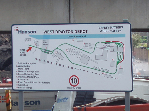
Image: © David Hawgood Taken: 18 May 2008
This map at the depot entrance shows that it has rail and canal discharge, Benninghoven B320 asphalt tower, cement premix, and storage bays.
Images are licensed for reuse under creativecommons.org/licenses/by-sa/2.0
Image Location
Latitude
51.50798
Longitude
-0.451265