Cromwell's Citadel
Introduction
The photograph on this page of Cromwell's Citadel by Alasdair MacNeill as part of the Geograph project.
The Geograph project started in 2005 with the aim of publishing, organising and preserving representative images for every square kilometre of Great Britain, Ireland and the Isle of Man.

There are currently over 7.5m images from over 14,400 individuals and you can help contribute to the project by visiting https://www.geograph.org.uk
Cromwell's Citadel
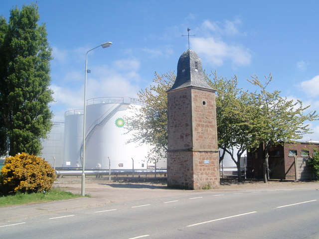
Image: © Alasdair MacNeill Taken: 25 May 2008
This tower is all that remains of the citadel built here by Oliver Cromwell, much to the annoyance of the locals. It's known locally as "the clocktower" but is actually the remains of a windmill. BP destroyed what was left of the fort under it's huge oil storage tanks, as seen in the background.
Images are licensed for reuse under creativecommons.org/licenses/by-sa/2.0
Image Location


Leaflet Map data © OpenStreetMap
Latitude
57.488607
Longitude
-4.2307