
Not the River Rother, Woodhouse Mill
Introduction
The photograph on this page of Not the River Rother, Woodhouse Mill by David Morris as part of the Geograph project.
The Geograph project started in 2005 with the aim of publishing, organising and preserving representative images for every square kilometre of Great Britain, Ireland and the Isle of Man.

There are currently over 7.5m images from over 14,400 individuals and you can help contribute to the project by visiting https://www.geograph.org.uk
Not the River Rother, Woodhouse Mill
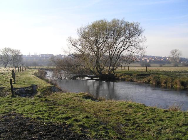
Image: © David Morris Taken: 19 Nov 2005
Although this looks like part of the River Rother, the course of the river is now a couple of hundred metres to the west. The course of the river was moved in the 1950's to alleviate frequent flooding problems. This bit was left behind to provide local factories with a source of water in the event of fire. The photo looks south-west towards Woodhouse. An easy walk from this square can be taken to Rother Valley Country Park.
Images are licensed for reuse under creativecommons.org/licenses/by-sa/2.0
Image Location

Latitude
53.364588
Longitude
-1.347773