Eller Beck and the Springs Branch, Skipton
Introduction
The photograph on this page of Eller Beck and the Springs Branch, Skipton by Dr Neil Clifton as part of the Geograph project.
The Geograph project started in 2005 with the aim of publishing, organising and preserving representative images for every square kilometre of Great Britain, Ireland and the Isle of Man.

There are currently over 7.5m images from over 14,400 individuals and you can help contribute to the project by visiting https://www.geograph.org.uk
Eller Beck and the Springs Branch, Skipton
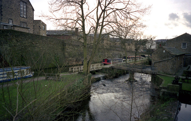
Image: © Dr Neil Clifton Taken: 1 Jan 1999
This is about as far as boats venture up the Springs Branch, as north of here it gets very shallow. Eller Beck both acts as a feeder, (higher up), and takes surplus water from the canal, (as seen here).
Images are licensed for reuse under creativecommons.org/licenses/by-sa/2.0
Image Location
Latitude
53.962282
Longitude
-2.018254