Bell Lane signalbox, Leicester 1979
Introduction
The photograph on this page of Bell Lane signalbox, Leicester 1979 by Peter Whatley as part of the Geograph project.
The Geograph project started in 2005 with the aim of publishing, organising and preserving representative images for every square kilometre of Great Britain, Ireland and the Isle of Man.

There are currently over 7.5m images from over 14,400 individuals and you can help contribute to the project by visiting https://www.geograph.org.uk
Bell Lane signalbox, Leicester 1979
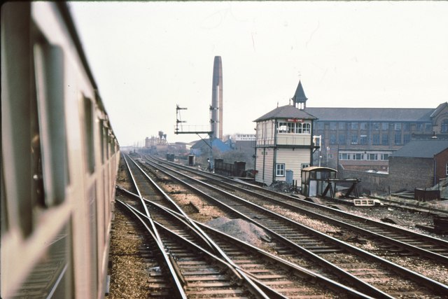
Image: © Peter Whatley Taken: Unknown
Situated 52 chains north of Leicester station, Bell Lane controlled the access to Needham Street yard. The signalbox was swept away by the Leicester area resignalling scheme.
Images are licensed for reuse under creativecommons.org/licenses/by-sa/2.0
Image Location
Latitude
52.63641
Longitude
-1.118822