By the side of the Afon Twymyn
Introduction
The photograph on this page of By the side of the Afon Twymyn by Rudi Winter as part of the Geograph project.
The Geograph project started in 2005 with the aim of publishing, organising and preserving representative images for every square kilometre of Great Britain, Ireland and the Isle of Man.

There are currently over 7.5m images from over 14,400 individuals and you can help contribute to the project by visiting https://www.geograph.org.uk
By the side of the Afon Twymyn
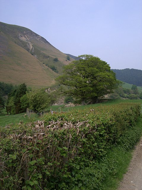
Image: © Rudi Winter Taken: 11 May 2008
At the bottom of the steep-sided Cwm Twymyn (Image) are fields used for sheep and cattle grazing. The hedge frames the track from Pennant (the village, Image) to Pennant Isaf (the farm, Image).
Images are licensed for reuse under creativecommons.org/licenses/by-sa/2.0
Image Location
Latitude
52.549366
Longitude
-3.661153