Footpath to Walmer
Introduction
The photograph on this page of Footpath to Walmer by Nick Smith as part of the Geograph project.
The Geograph project started in 2005 with the aim of publishing, organising and preserving representative images for every square kilometre of Great Britain, Ireland and the Isle of Man.

There are currently over 7.5m images from over 14,400 individuals and you can help contribute to the project by visiting https://www.geograph.org.uk
Footpath to Walmer
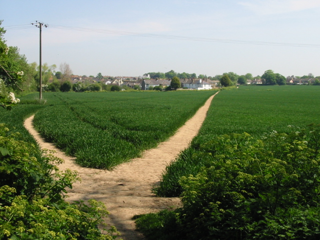
Image: © Nick Smith Taken: 11 May 2008
These paths are a bit confusing, the map shows two footpaths from this corner, one running roughly NE to Walmer the other roughly SE towards Kings Farm on the A258. The two tracks shown here seem to run in the same direction, the left hand one appears to curve around and join the other one in the distance.
Images are licensed for reuse under creativecommons.org/licenses/by-sa/2.0
Image Location
Latitude
51.199658
Longitude
1.378883