10 Douglas Drive, Shirley, Croydon
Introduction
The photograph on this page of 10 Douglas Drive, Shirley, Croydon by Dave Hilliam as part of the Geograph project.
The Geograph project started in 2005 with the aim of publishing, organising and preserving representative images for every square kilometre of Great Britain, Ireland and the Isle of Man.

There are currently over 7.5m images from over 14,400 individuals and you can help contribute to the project by visiting https://www.geograph.org.uk
10 Douglas Drive, Shirley, Croydon
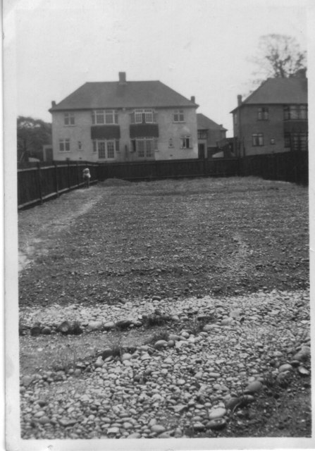
Image: © Dave Hilliam Taken: 10 Apr 1938
Rear garden on the brand new house in April 1938. The backs of the houses are those in Lime Tree Grove, with one of the old Lime Trees showing above the one on the right. The ground was full of rounded pebbles that have been collected to make a makeshift pathway. Dad used say that a cart track ran across the middle of the garden, but it is not evident in the photo.
Images are licensed for reuse under creativecommons.org/licenses/by-sa/2.0
Image Location
Latitude
51.370491
Longitude
-0.032083