
Lady Spencer?s Walk
Introduction
The photograph on this page of Lady Spencer?s Walk by Alan Walker as part of the Geograph project.
The Geograph project started in 2005 with the aim of publishing, organising and preserving representative images for every square kilometre of Great Britain, Ireland and the Isle of Man.

There are currently over 7.5m images from over 14,400 individuals and you can help contribute to the project by visiting https://www.geograph.org.uk
Lady Spencer?s Walk
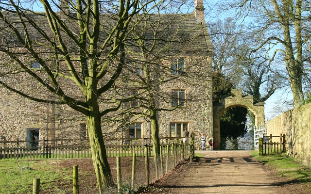
Image: © Alan Walker Taken: 10 Feb 2008
Image : last – (image 1 of 21) – next : Image There are various versions of this walk produced by different organisations. This one has a certain historical value in that part of the walk follows a route created for a Lady Spencer. To begin the walk park your car in the visitor car park adjacent to the hall and then walk south on the road by the side the wall along the front of the building. You’ll pass Image along your way. At the end of the garden wall there is a sign for Lady Spencer’s Walk that leads you easterly, through an arched entrance into the old (large) stable yard. This photograph shows the entrance from the path inside the stable yard. The route continues behind the viewpoint by the side of the garden wall. About halfway along the wall is a gated (locked) entrance into the south garden from where there is this view of the Image Visitors are asked to stay on the path because private tenants occupy many of the buildings in this enclosure. For this reason the section of the footpath through the stable yard is only open between 09:00 and 17:00. See also this photograph of the stable yard taken by Derek Harper: Image - - - Another (6 mile) walk with the same title can be found here: http://www.teversaltrails.com/spencer.htm
Images are licensed for reuse under creativecommons.org/licenses/by-sa/2.0
Image Location

Latitude
53.167249
Longitude
-1.31008