Cowley: Church of St Laurence
Introduction
The photograph on this page of Cowley: Church of St Laurence by Nigel Cox as part of the Geograph project.
The Geograph project started in 2005 with the aim of publishing, organising and preserving representative images for every square kilometre of Great Britain, Ireland and the Isle of Man.

There are currently over 7.5m images from over 14,400 individuals and you can help contribute to the project by visiting https://www.geograph.org.uk
Cowley: Church of St Laurence
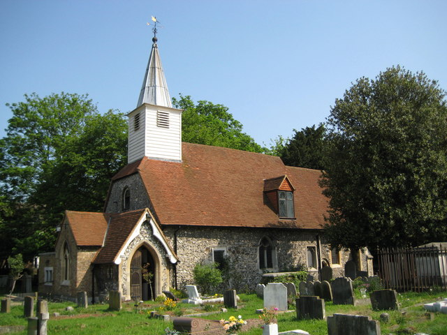
Image: © Nigel Cox Taken: 11 May 2008
This attractive little church is on the east side of Church Road and at the eastern extremity of Cowley. Apart from the fact that Roman remains were found here in 1959 I can find no other information about the church on the internet. From a cartographical point of view this is a fine illustration of the relative inaccuracies of the Ordnance Survey 1:50,000 scale mapping. This shows the symbol for a church with a steeple clearly in the adjacent grid square Image, but using the more accurate 1:10,000 scale mapping the church is clearly mainly in this grid square. This was an unplanned and inadvertent copy of a Francis Frith image of around 1955, here http://www.francisfrith.com/search/england/middlesex/cowley/photos/cowley_C581006.htm
Images are licensed for reuse under creativecommons.org/licenses/by-sa/2.0
Image Location
Latitude
51.526992
Longitude
-0.474839