Uxbridge: Windsor Street (1)
Introduction
The photograph on this page of Uxbridge: Windsor Street (1) by Nigel Cox as part of the Geograph project.
The Geograph project started in 2005 with the aim of publishing, organising and preserving representative images for every square kilometre of Great Britain, Ireland and the Isle of Man.

There are currently over 7.5m images from over 14,400 individuals and you can help contribute to the project by visiting https://www.geograph.org.uk
Uxbridge: Windsor Street (1)
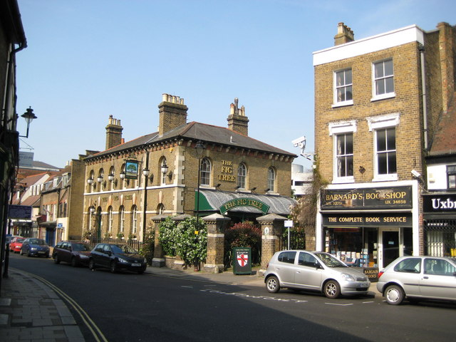
Image: © Nigel Cox Taken: 11 May 2008
Prominent in the photograph is The Fig Tree public house, a Greene King outlet. This was originally built as the town's police station, but was later converted to a public house with the inevitable name of The Old Bill. The transformation to The Fig Tree is recent, from around the beginning of 2006. Apparently and allegedly the new name had to fit to the number of letters of the old name on the outside of the building to circumvent certain planning regulations! Barnard's Bookshop is to the right.
Images are licensed for reuse under creativecommons.org/licenses/by-sa/2.0
Image Location
Latitude
51.545062
Longitude
-0.481446