Bedford Bridge
Introduction
The photograph on this page of Bedford Bridge by Tony Atkin as part of the Geograph project.
The Geograph project started in 2005 with the aim of publishing, organising and preserving representative images for every square kilometre of Great Britain, Ireland and the Isle of Man.

There are currently over 7.5m images from over 14,400 individuals and you can help contribute to the project by visiting https://www.geograph.org.uk
Bedford Bridge
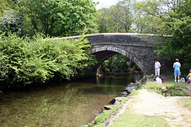
Image: © Tony Atkin Taken: 11 May 2008
Bedford Bridge takes the main road between Plymouth and Tavistock over the River Walkham. A nearby car park makes the meadows by the bridge a popular recreation spot especially on a May Sunday like today where the temperature is exactly what you might hope for in August - it's hot!
Images are licensed for reuse under creativecommons.org/licenses/by-sa/2.0
Image Location


Leaflet Map data © OpenStreetMap
Latitude
50.513683
Longitude
-4.111384