Kirkwood from the air
Introduction
The photograph on this page of Kirkwood from the air by Thomas Nugent as part of the Geograph project.
The Geograph project started in 2005 with the aim of publishing, organising and preserving representative images for every square kilometre of Great Britain, Ireland and the Isle of Man.

There are currently over 7.5m images from over 14,400 individuals and you can help contribute to the project by visiting https://www.geograph.org.uk
Kirkwood from the air
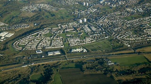
Image: © Thomas Nugent Taken: 19 Dec 2024
The M8 motorway and the leisure Park at Kirkwood, Coatbridge, viewed from 5,000 feet above the Maryville Interchange at the M73/M74 junction. Old Monkland Cemetery is also visible.
Images are licensed for reuse under creativecommons.org/licenses/by-sa/2.0
Image Location


Leaflet Map data © OpenStreetMap
Latitude
55.84417
Longitude
-4.061608