Castleman Trailway, Broadstone
Introduction
The photograph on this page of Castleman Trailway, Broadstone by Malc McDonald as part of the Geograph project.
The Geograph project started in 2005 with the aim of publishing, organising and preserving representative images for every square kilometre of Great Britain, Ireland and the Isle of Man.

There are currently over 7.5m images from over 14,400 individuals and you can help contribute to the project by visiting https://www.geograph.org.uk
Castleman Trailway, Broadstone
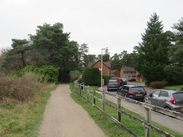
Image: © Malc McDonald Taken: 30 Dec 2024
A view of the Castleman Trailway heading north out of Broadstone. This section of the path is also on route 25 of the National Cycle Network. This is the site of a railway junction just to the north of Broadstone station. The path curving off to the left is on the trackbed of the former Somerset & Dorset Joint Railway, which closed in 1966. The road and houses to the right occupy the trackbed of the former line to Wimborne which closed in 1964. These closures were part of the "Beeching Cuts". A short distance further on from where this image was taken, the Castleman Trailway will leave the route of the Somerset & Dorset line and cross over to take up the route towards Wimborne.
Images are licensed for reuse under creativecommons.org/licenses/by-sa/2.0
Image Location


Leaflet Map data © OpenStreetMap
Latitude
50.765838
Longitude
-1.994276