Close-up, Boundary, Mile and Datum Stone, on old railway bridge, Warrington Road, Spring View
Introduction
The photograph on this page of Close-up, Boundary, Mile and Datum Stone, on old railway bridge, Warrington Road, Spring View by David Long as part of the Geograph project.
The Geograph project started in 2005 with the aim of publishing, organising and preserving representative images for every square kilometre of Great Britain, Ireland and the Isle of Man.

There are currently over 7.5m images from over 14,400 individuals and you can help contribute to the project by visiting https://www.geograph.org.uk
Close-up, Boundary, Mile and Datum Stone, on old railway bridge, Warrington Road, Spring View
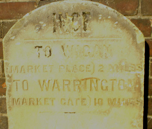
Image: © David Long Taken: 16 Nov 2005
Images are licensed for reuse under creativecommons.org/licenses/by-sa/2.0
Image Location


Leaflet Map data © OpenStreetMap
Latitude
53.523926
Longitude
-2.606326