Llandysul Park
Introduction
The photograph on this page of Llandysul Park by Marion Phillips as part of the Geograph project.
The Geograph project started in 2005 with the aim of publishing, organising and preserving representative images for every square kilometre of Great Britain, Ireland and the Isle of Man.

There are currently over 7.5m images from over 14,400 individuals and you can help contribute to the project by visiting https://www.geograph.org.uk
Llandysul Park
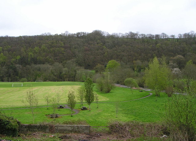
Image: © Marion Phillips Taken: 30 Apr 2008
This photographs shows an area of flat land round which sweeps the Afon Teifi, visible on the right. This is a flood plain so there are no houses here but the land is used for recreation with playing fields, picnic area, bowling green and tennis courts (the last two out of sight to the left). The steep slope on the other side of the river is clothed in woodland with some of the trees now in leaf while others retain their bare winter branches.
Images are licensed for reuse under creativecommons.org/licenses/by-sa/2.0
Image Location


Leaflet Map data © OpenStreetMap
Latitude
52.03928
Longitude
-4.307793