Site of St Luke's station
Introduction
The photograph on this page of Site of St Luke's station by Oliver Dixon as part of the Geograph project.
The Geograph project started in 2005 with the aim of publishing, organising and preserving representative images for every square kilometre of Great Britain, Ireland and the Isle of Man.

There are currently over 7.5m images from over 14,400 individuals and you can help contribute to the project by visiting https://www.geograph.org.uk
Site of St Luke's station
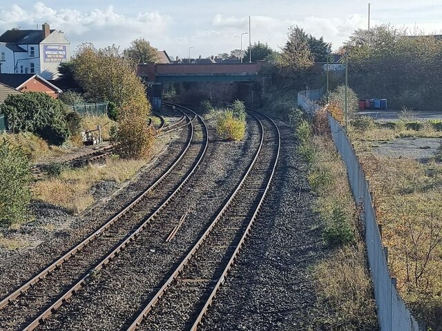
Image: © Oliver Dixon Taken: 22 Oct 2024
Seen from the Windsor Road footbridge. St Luke's was a station (open 1883 to 1968) a short way from the town centre which served three railway routes - to Preston, the Barton branch and the direct line to Manchester via Blowick. The first two passed under the bridge in view, the latter under a further span of the bridge to the right (south). The only service now passing along this line is to Manchester via Meols Cop.
Images are licensed for reuse under creativecommons.org/licenses/by-sa/2.0
Image Location
Latitude
53.643526
Longitude
-2.989234