Sunny Bank Farm
Introduction
The photograph on this page of Sunny Bank Farm by Roger May as part of the Geograph project.
The Geograph project started in 2005 with the aim of publishing, organising and preserving representative images for every square kilometre of Great Britain, Ireland and the Isle of Man.

There are currently over 7.5m images from over 14,400 individuals and you can help contribute to the project by visiting https://www.geograph.org.uk
Sunny Bank Farm
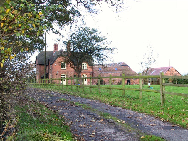
Image: © Roger May Taken: 15 Nov 2005
Looks idyllic doesn't it? Except it now has the extension to the runway at Manchester International Airport in the back garden. Compare the modern OS map to the one from the 1940's.
Images are licensed for reuse under creativecommons.org/licenses/by-sa/2.0
Image Location
Latitude
53.325502
Longitude
-2.315245