Historic land use conflict over the siting of Montrose Guildhall
Introduction
The photograph on this page of Historic land use conflict over the siting of Montrose Guildhall by Adrian Diack as part of the Geograph project.
The Geograph project started in 2005 with the aim of publishing, organising and preserving representative images for every square kilometre of Great Britain, Ireland and the Isle of Man.

There are currently over 7.5m images from over 14,400 individuals and you can help contribute to the project by visiting https://www.geograph.org.uk
Historic land use conflict over the siting of Montrose Guildhall
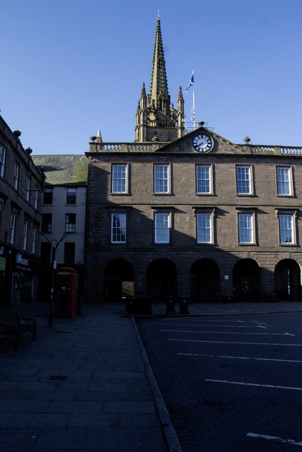
Image: © Adrian Diack Taken: 29 Jun 2023
The photo shows Montrose Guildhall as seen from the High Street looking south. In 1760, the rumour of a proposed new townhouse or Guildhall in Montrose became a reality when a committee headed by Provost James Bisset decided that the garden area of Patrick Scott’s property called ‘Scott’s Land’ was the most suitable place on which to build. Patrick Scott opposed the proposal to the extent that he threatened the Council with an interdict, and a bill of suspension was called into force. Despite Scott’s vehement opposition, the Guildhall was completed in 1764.
Images are licensed for reuse under creativecommons.org/licenses/by-sa/2.0
Image Location
Latitude
56.710926
Longitude
-2.467967