Stanhope Hall
Introduction
The photograph on this page of Stanhope Hall by Robert Graham as part of the Geograph project.
The Geograph project started in 2005 with the aim of publishing, organising and preserving representative images for every square kilometre of Great Britain, Ireland and the Isle of Man.

There are currently over 7.5m images from over 14,400 individuals and you can help contribute to the project by visiting https://www.geograph.org.uk
Stanhope Hall
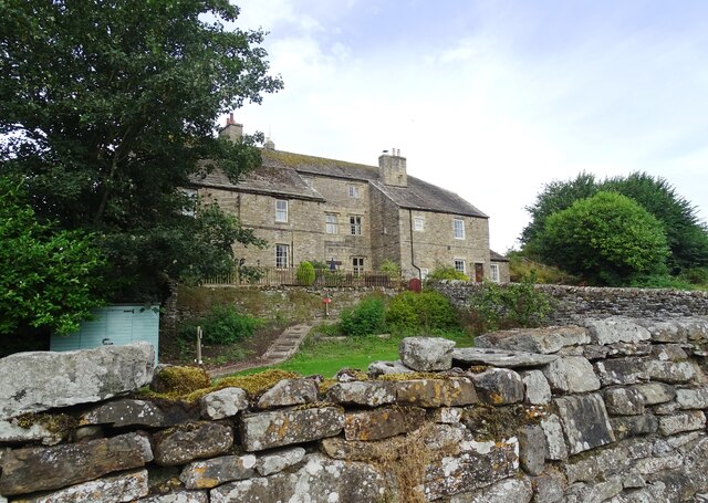
Image: © Robert Graham Taken: 13 Aug 2024
Old mansion on the west side of Stanhope town. It dates from the 16th and 17th centuries with later alterations. The house incorporates elements from medieval times.
Images are licensed for reuse under creativecommons.org/licenses/by-sa/2.0
Image Location


Leaflet Map data © OpenStreetMap
Latitude
54.749374
Longitude
-2.017368