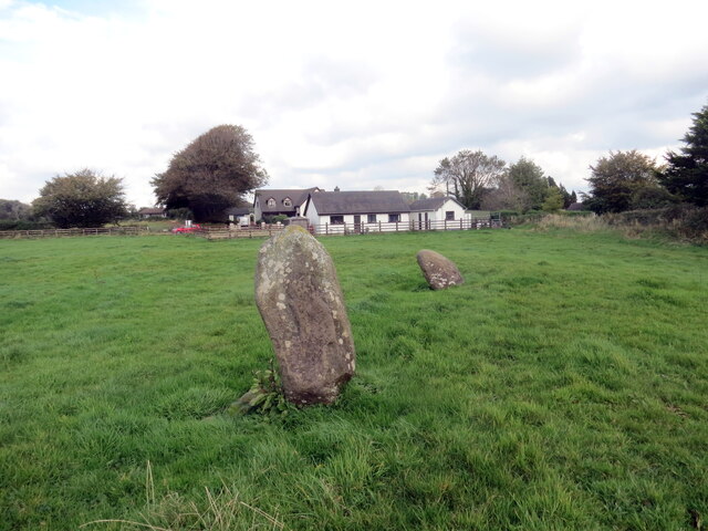
Cylch Cerrig Meini Gwyr / Meini Gwyr Stone Circle
Introduction
The photograph on this page of Cylch Cerrig Meini Gwyr / Meini Gwyr Stone Circle by Alan Richards as part of the Geograph project.
The Geograph project started in 2005 with the aim of publishing, organising and preserving representative images for every square kilometre of Great Britain, Ireland and the Isle of Man.
There are currently over 7.5m images from over 14,400 individuals and you can help contribute to the project by visiting https://www.geograph.org.uk

Image: © Alan Richards Taken: 4 Oct 2024
Gweddillion cylch cerrig a chlawdd o'r enw Meini Gwyr. Mae'r safle yn dyddio o'r Oes Neolithig i'r Oes Efydd Cynnar (c.2000CC). Yn affodus dau faen yn unig sy wedi goroesi er bod y clawdd i'w weld o hyd. Pan ymwelodd yr hynafieithydd enwog Edward Lhuyd â'r safle yn 1695 gwelodd cylch yn cynnwys 15 o feini a amrywient rhwng 3 troedfedd i 6 troedfedd o ddaldra. Mae'n druenu mawr bod safle pwysig a oroesodd am 4,000 o flynyddoedd wedi'i ysbeilio am ei garreg yn fwy diweddar. The remains of Meini Gwyr (trans. slanting stones), an embanked stone circle which dates from the Neolithic to the Early Bronze Age (c.2000BC). Unfortunately, only two stones remain but the circular embankment is still discernible. When famous antiquarian Edward Lhuyd visited the site in 1695 he saw 15 stones ranging in height from 3 ft to 6 ft. It's such a shame that an important site which had survived for 4,000 years was plundered for its stone in more recent times.

