On a wall in Andersonstown, Belfast
Introduction
The photograph on this page of On a wall in Andersonstown, Belfast by Marathon as part of the Geograph project.
The Geograph project started in 2005 with the aim of publishing, organising and preserving representative images for every square kilometre of Great Britain, Ireland and the Isle of Man.

There are currently over 7.5m images from over 14,400 individuals and you can help contribute to the project by visiting https://www.geograph.org.uk
On a wall in Andersonstown, Belfast
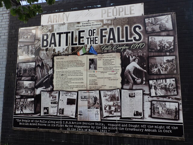
Image: © Marathon Taken: 15 Aug 2024
Walking around Belfast now, although you feel quite safe, the Unionist and Republican areas still have their distinctive murals and panels so there is never any doubt which area you are in. This is on a wall in the Republican Falls Road in Andersonstown, West Belfast and is on the corner of Northumberland Street, close to the junction with Falls Road. For more information about the Battle of the Falls see https://thehistorypress.co.uk/article/the-falls-curfew-reassessing-the-past/ and another board near the Falls Road Garden of Remembrance can be seen at https://www.geograph.org.uk/photo/7883077.
Images are licensed for reuse under creativecommons.org/licenses/by-sa/2.0
Image Location
Latitude
54.600304
Longitude
-5.946945