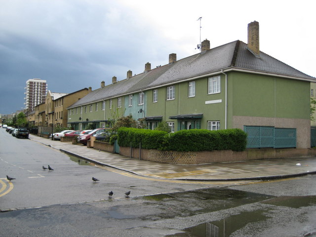
Stepney: Limehouse Fields Estate, E14
Introduction
The photograph on this page of Stepney: Limehouse Fields Estate, E14 by Nigel Cox as part of the Geograph project.
The Geograph project started in 2005 with the aim of publishing, organising and preserving representative images for every square kilometre of Great Britain, Ireland and the Isle of Man.
There are currently over 7.5m images from over 14,400 individuals and you can help contribute to the project by visiting https://www.geograph.org.uk

Image: © Nigel Cox Taken: 1 May 2008
Stepney suffered greatly during the Blitz, and there was a desperate need in the immediate post-war years not only to re-house people whose homes had been destroyed but also to cater for demobilized service personnel returning home to civilian life. The Limehouse Fields Estate was one of the main developments to solve these problems. Three different types of housing can be seen here. The nearest, and somewhat unusually green, houses are Donoghue Cottages, built in 1949. Further down the road, which is Galsworthy Avenue, are some more recent (1990s?) houses, while in the distance is a towerblock, probably dating from the 1960s.

