St Michael's Church, Halton
Introduction
The photograph on this page of St Michael's Church, Halton by Mark Percy as part of the Geograph project.
The Geograph project started in 2005 with the aim of publishing, organising and preserving representative images for every square kilometre of Great Britain, Ireland and the Isle of Man.

There are currently over 7.5m images from over 14,400 individuals and you can help contribute to the project by visiting https://www.geograph.org.uk
St Michael's Church, Halton
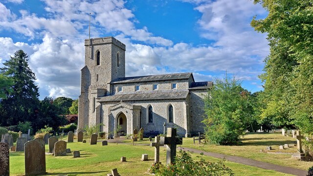
Image: © Mark Percy Taken: 8 Sep 2024
The church was rebuilt in 1813 and altered again in 1886. 104 military casualties of the First and Second World Wars are buried here, and there are close links with the nearby RAF Halton. In 1931 the Air Ministry gave the ecclesiastical authorities a piece of land to the east so the churchyard could be extended. It is in this part that most of the 1939-1945 war graves lie.
Images are licensed for reuse under creativecommons.org/licenses/by-sa/2.0
Image Location
Latitude
51.782741
Longitude
-0.733846