Wye Grove
Introduction
The photograph on this page of Wye Grove by Ian Capper as part of the Geograph project.
The Geograph project started in 2005 with the aim of publishing, organising and preserving representative images for every square kilometre of Great Britain, Ireland and the Isle of Man.

There are currently over 7.5m images from over 14,400 individuals and you can help contribute to the project by visiting https://www.geograph.org.uk
Wye Grove
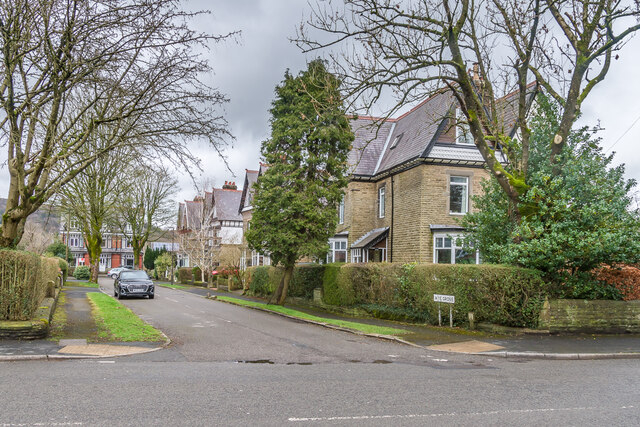
Image: © Ian Capper Taken: 12 Mar 2024
Cul-de-sac of large Edwardian houses off Macclesfield Road, first shown on the 1922 25" map. The Buxton Conservation Area appraisal of April 2007 describes the road as follows: "... the outlandish character of Wye Grove, which comprises three-storey semi-detached houses built with a distinctive, jettied, third (attic) storey, marked by a broad, plastered, coved eaves and highly decorative bargeboards. The buildings are mainly stone and render but each pair is different and some also incorporate moulded bricks, terracotta and slate-hanging. The black and white timbering is not used in the vernacular tradition but is used as applied decoration in combination with tile-hanging, most of which has been painted white. Numbers 7 & 8 (the ones at the far end of the road in this photo) are the most unusual, incorporating a little of everything, with filigree details."
Images are licensed for reuse under creativecommons.org/licenses/by-sa/2.0
Image Location
Latitude
53.253868
Longitude
-1.922485