Engineering work around Heath Low Level station
Introduction
The photograph on this page of Engineering work around Heath Low Level station by Gareth James as part of the Geograph project.
The Geograph project started in 2005 with the aim of publishing, organising and preserving representative images for every square kilometre of Great Britain, Ireland and the Isle of Man.

There are currently over 7.5m images from over 14,400 individuals and you can help contribute to the project by visiting https://www.geograph.org.uk
Engineering work around Heath Low Level station
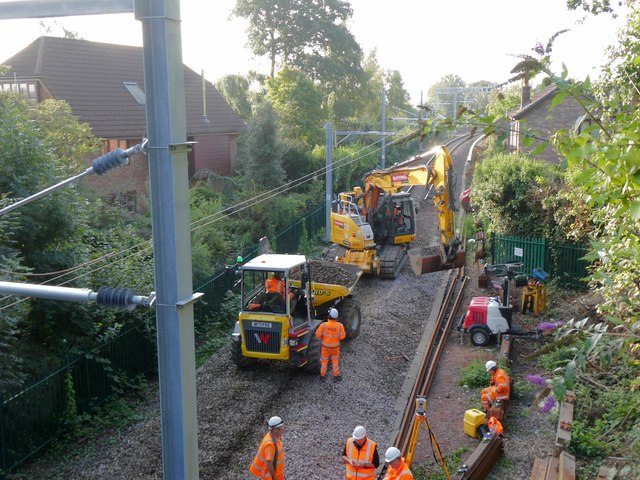
Image: © Gareth James Taken: 31 Aug 2024
A section of track beneath Heath Halt Road bridge is being lowered to give additional clearance for the newly-installed overhead wired. Here, the old track has been removed and the ballast bed is being dug out.
Images are licensed for reuse under creativecommons.org/licenses/by-sa/2.0
Image Location
Latitude
51.514676
Longitude
-3.18151