Old farm outbuildings
Introduction
The photograph on this page of Old farm outbuildings by Robert Graham as part of the Geograph project.
The Geograph project started in 2005 with the aim of publishing, organising and preserving representative images for every square kilometre of Great Britain, Ireland and the Isle of Man.

There are currently over 7.5m images from over 14,400 individuals and you can help contribute to the project by visiting https://www.geograph.org.uk
Old farm outbuildings
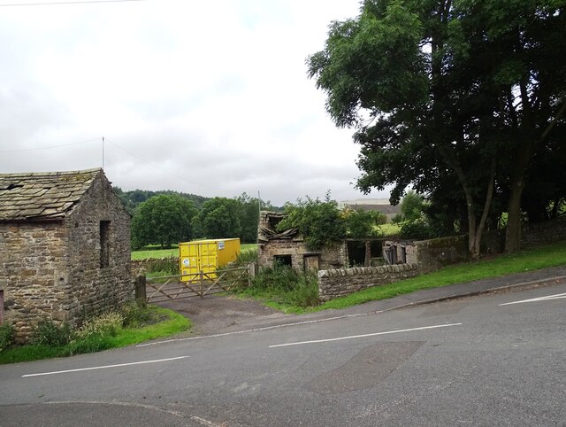
Image: © Robert Graham Taken: 23 Jul 2024
At Shittlehope Burn Farm on the east edge of Stanhope. The building on the left is a byre with hayloft over. Note the doorway to the hayloft at first floor level. The ruined building on the right could have been a stable or a byre. Note the stone roof slates on both.
Images are licensed for reuse under creativecommons.org/licenses/by-sa/2.0
Image Location


Leaflet Map data © OpenStreetMap
Latitude
54.741557
Longitude
-1.997172