Old Milestone by the B3357, Lower Longford, Whitchurch parish
Introduction
The photograph on this page of Old Milestone by the B3357, Lower Longford, Whitchurch parish by Pete McCrickard as part of the Geograph project.
The Geograph project started in 2005 with the aim of publishing, organising and preserving representative images for every square kilometre of Great Britain, Ireland and the Isle of Man.

There are currently over 7.5m images from over 14,400 individuals and you can help contribute to the project by visiting https://www.geograph.org.uk
Old Milestone by the B3357, Lower Longford, Whitchurch parish
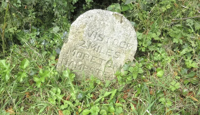
Image: © Pete McCrickard Taken: 24 Aug 2024
Carved stone post by the B3357, in parish of Whitchurch (West Devon District), East of Moorshop crossroads; 50m West of turn to Lower Longford Farm, sunken in bank under hedge, on North side of road. Dartmoor granite tombstone, erected by the Tavistock turnpike trust in the 19th century. Inscription reads:- TAVISTOCK 2 MILES MORETON HAMPSTEAD 18 Rivet benchmark on top. Milestone Society National ID: DV_TVAS02
Images are licensed for reuse under creativecommons.org/licenses/by-sa/2.0
Image Location
Latitude
50.553026
Longitude
-4.096808