Benchmark on farm building on south side of road at Nova Scotia
Introduction
The photograph on this page of Benchmark on farm building on south side of road at Nova Scotia by Roger Templeman as part of the Geograph project.
The Geograph project started in 2005 with the aim of publishing, organising and preserving representative images for every square kilometre of Great Britain, Ireland and the Isle of Man.

There are currently over 7.5m images from over 14,400 individuals and you can help contribute to the project by visiting https://www.geograph.org.uk
Benchmark on farm building on south side of road at Nova Scotia
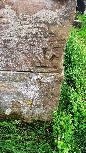
Image: © Roger Templeman Taken: 15 May 2024
Ordnance Survey records describe a cut mark benchmark levelled at 27.953m above Newlyn Datum verified 1970 at this location. The mark is inverted so it may have been relocated invalidating the levelled height
Images are licensed for reuse under creativecommons.org/licenses/by-sa/2.0
Image Location
Latitude
54.83323
Longitude
-3.130334