Information on the door of the Ha'penny Bridge House
Introduction
The photograph on this page of Information on the door of the Ha'penny Bridge House by Richard Sutcliffe as part of the Geograph project.
The Geograph project started in 2005 with the aim of publishing, organising and preserving representative images for every square kilometre of Great Britain, Ireland and the Isle of Man.

There are currently over 7.5m images from over 14,400 individuals and you can help contribute to the project by visiting https://www.geograph.org.uk
Information on the door of the Ha'penny Bridge House
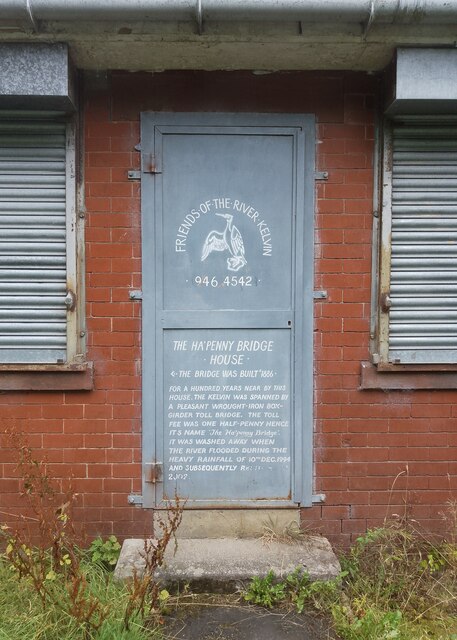
Image: © Richard Sutcliffe Taken: 13 Aug 2024
THE HA’PENNY BRIDGE HOUSE THE BRIDGE WAS BUILT c.1886 FOR A HUNDRED YEARS NEAR BY THIS HOUSE, THE KELVIN WAS SPANNED BY A PLEASANT WROUGHT-IRON BOX- GIRDER TOLL BRIDGE. THE TOLL FEE WAS ONE HALF-PENNY HENCE ITS NAME ‘THE HA’PENNY BRIDGE’. IT WAS WASHED AWAY WHEN THE RIVER FLOODED DURING THE HEAVY RAIN OF 10TH DEC. 1994 AND SUBSEQUENTLY RESTORED IN 2002.
Images are licensed for reuse under creativecommons.org/licenses/by-sa/2.0
Image Location
Latitude
55.881353
Longitude
-4.291579