Bridge abutment
Introduction
The photograph on this page of Bridge abutment by Richard Sutcliffe as part of the Geograph project.
The Geograph project started in 2005 with the aim of publishing, organising and preserving representative images for every square kilometre of Great Britain, Ireland and the Isle of Man.

There are currently over 7.5m images from over 14,400 individuals and you can help contribute to the project by visiting https://www.geograph.org.uk
Bridge abutment
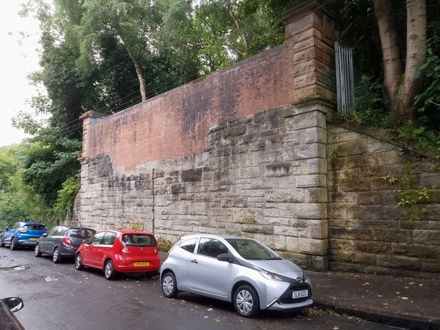
Image: © Richard Sutcliffe Taken: 13 Aug 2024
The abutment on the south side of Ford Road for the bridge which once carried the Glasgow Central Railway. Kirklee Station was just to the north of it. The platforms extended over the bridge and the infilling by bricks clearly shows where the trackbed was in relation to the platforms. The line opened in 1894 and closed to all traffic in 1964.
Images are licensed for reuse under creativecommons.org/licenses/by-sa/2.0
Image Location
Latitude
55.881694
Longitude
-4.292559