Housing at Junction of Friars Terrace and Park Street, Stafford
Introduction
The photograph on this page of Housing at Junction of Friars Terrace and Park Street, Stafford by Rod Grealish as part of the Geograph project.
The Geograph project started in 2005 with the aim of publishing, organising and preserving representative images for every square kilometre of Great Britain, Ireland and the Isle of Man.

There are currently over 7.5m images from over 14,400 individuals and you can help contribute to the project by visiting https://www.geograph.org.uk
Housing at Junction of Friars Terrace and Park Street, Stafford
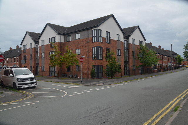
Image: © Rod Grealish Taken: 15 Jul 2024
This housing development was built in 2015 on the site of Staffordshire County Library and Record (music) Library in Friars Terrace. The housing runs from the extreme left of the image to the extreme right. The library was built in the 1960's(?) as the headquarters of the library service which served those areas of Staffordshire outside of the boroughs for which there was no locally provided library service. Under local government re-organisation in 1974 libraries became a county function and the building became the headquarters of the Staffordshire library service. The housing was built by Stafford and Rural Homes (SARH), a housing association, and the successor to Stafford Borough housing.
Images are licensed for reuse under creativecommons.org/licenses/by-sa/2.0
Image Location
Latitude
52.80099
Longitude
-2.11654