Lower Farm Cottages, Chettle
Introduction
The photograph on this page of Lower Farm Cottages, Chettle by Derek Harper as part of the Geograph project.
The Geograph project started in 2005 with the aim of publishing, organising and preserving representative images for every square kilometre of Great Britain, Ireland and the Isle of Man.

There are currently over 7.5m images from over 14,400 individuals and you can help contribute to the project by visiting https://www.geograph.org.uk
Lower Farm Cottages, Chettle
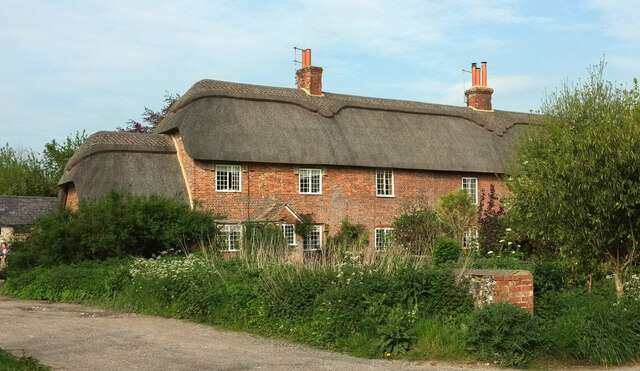
Image: © Derek Harper Taken: 8 May 2024
A clearer view of the listed cottages seen in Image], "Row of 3 Cottages, late C18 with various C19 alterations. Flemish bond brickwork, thatched roof with tiled bay to right" https://historicengland.org.uk/listing/the-list/list-entry/1324297?section=official-list-entry .
Images are licensed for reuse under creativecommons.org/licenses/by-sa/2.0
Image Location
Latitude
50.920309
Longitude
-2.06852