National Grid investigations on land near Barton Upon Humber: aerial 2024 (1)
Introduction
The photograph on this page of National Grid investigations on land near Barton Upon Humber: aerial 2024 (1) by Simon Tomson as part of the Geograph project.
The Geograph project started in 2005 with the aim of publishing, organising and preserving representative images for every square kilometre of Great Britain, Ireland and the Isle of Man.

There are currently over 7.5m images from over 14,400 individuals and you can help contribute to the project by visiting https://www.geograph.org.uk
National Grid investigations on land near Barton Upon Humber: aerial 2024 (1)
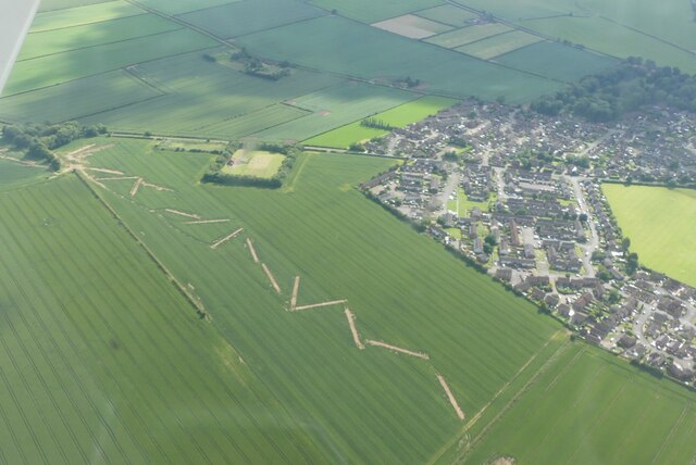
Image: © Simon Tomson Taken: 22 Jun 2024
It is believed these are in connection with the "Great Grid Upgrade" which could involve running a line of pylons across the Lincolnshire countryside. There are several such sites along the suggested route of the pylons. See also Image
Images are licensed for reuse under creativecommons.org/licenses/by-sa/2.0
Image Location
Latitude
53.676887
Longitude
-0.424017