Listed cottages, Berry Head Road
Introduction
The photograph on this page of Listed cottages, Berry Head Road by Derek Harper as part of the Geograph project.
The Geograph project started in 2005 with the aim of publishing, organising and preserving representative images for every square kilometre of Great Britain, Ireland and the Isle of Man.

There are currently over 7.5m images from over 14,400 individuals and you can help contribute to the project by visiting https://www.geograph.org.uk
Listed cottages, Berry Head Road
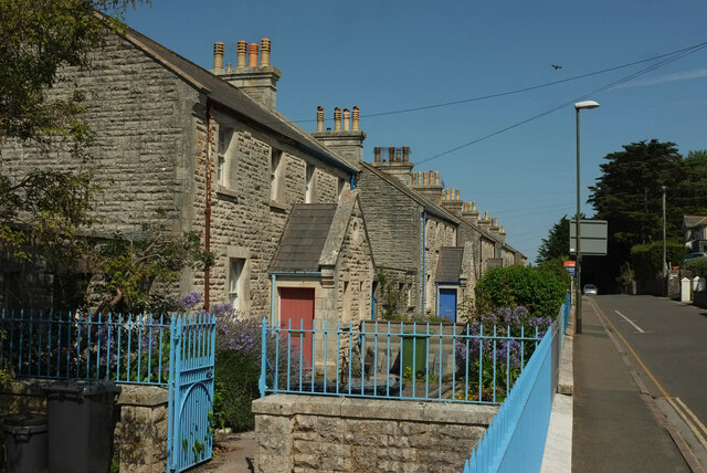
Image: © Derek Harper Taken: 30 Jul 2024
A listed terrace https://historicengland.org.uk/listing/the-list/list-entry/1298256?section=official-list-entry . "5 linked pairs of semi-detached cottages, originally built for coastguards. c1889. Squared rough-faced Devonian limestone rubble ... in front of the whole range of houses is a low stone wall having a chamfered limestone coping and an iron railing with simple pointed uprights. Nos 14-20 & 24 have gates to match". The blue plaque shown in Image is towards the end of this row. To the left of the camera is the separately-listed Image
Images are licensed for reuse under creativecommons.org/licenses/by-sa/2.0
Image Location
Latitude
50.400604
Longitude
-3.498602